Da Nang Weather by Month: When to Go and When Not To
October is Da Nang's wettest month, with 628.0 mm of rain, and September to December brings most of the rain. February to April is the driest stretch, at 23.6 to 35.3 mm a month. June and July are the hottest months at about 29 degrees.
On this page
October is the month most visitors get wrong. Da Nang’s official mean rainfall for October is 628.0 mm, against 23.6 mm in February. The table below lists every month.
All figures here come from the national construction standard QCVN 02:2022/BXD. They are long-term monthly means for the Da Nang station, not a forecast for any one year.
Da Nang weather by month
Mean temperature, rainfall and rainy days for each month. The last row is the full year.
| Month | Mean °C | Rain mm | Rainy days |
|---|---|---|---|
| January | 21.5 | 81.9 | 12.0 |
| February | 22.4 | 23.6 | 5.6 |
| March | 24.2 | 25.0 | 4.8 |
| April | 26.5 | 35.3 | 5.4 |
| May | 28.4 | 81.1 | 9.2 |
| June | 29.4 | 82.6 | 8.1 |
| July | 29.3 | 92.5 | 9.4 |
| August | 29.0 | 141.2 | 11.6 |
| September | 27.6 | 350.7 | 14.6 |
| October | 26.0 | 628.0 | 20.0 |
| November | 24.4 | 448.2 | 20.3 |
| December | 22.2 | 218.4 | 18.7 |
| Year | 25.9 | 2205.0 | 139.1 |
Month by month in short
- January to April: rainfall drops from 81.9 mm in January to 23.6 mm in February, 25.0 mm in March and 35.3 mm in April.
- May to July: means of 28.4, 29.4 and 29.3 degrees, with June the warmest month of the year and 246.7, 242.3 and 246.2 sunshine hours.
- August: a mean of 29.0 degrees, and rainfall rises to 141.2 mm, with 11.6 rainy days.
- September to November: rain reaches 350.7, 628.0 and 448.2 mm, and October and November each have about 20 rainy days.
- December: 218.4 mm of rain and 18.7 rainy days, with the lowest sunshine of the year at 94.8 hours.
Humidity is highest in December at 85.4% and lowest in July at 75.8%. Sunshine is lowest in November and December, at 117.7 and 94.8 hours.
Flood season and flooding in town
The legal river flood season on rivers from Quang Binh to Ninh Thuan runs from 1 September to 15 December. That is a definition for rivers, not a storm calendar.
The Department of Construction found that flooding begins to appear at 9 areas once rain reaches about 40-50 mm an hour. See which streets flood in heavy rain.
You can track live rainfall on the city flood map at muangap.danang.gov.vn, which uses data from 44 rain-gauge stations.
Typhoon outlook
Each forecast below covers one year. In 2024, the national forecasting centre said typhoon and tropical-depression activity was likely to concentrate from October to December in the Trung Trung Bo and Nam Trung Bo regions.
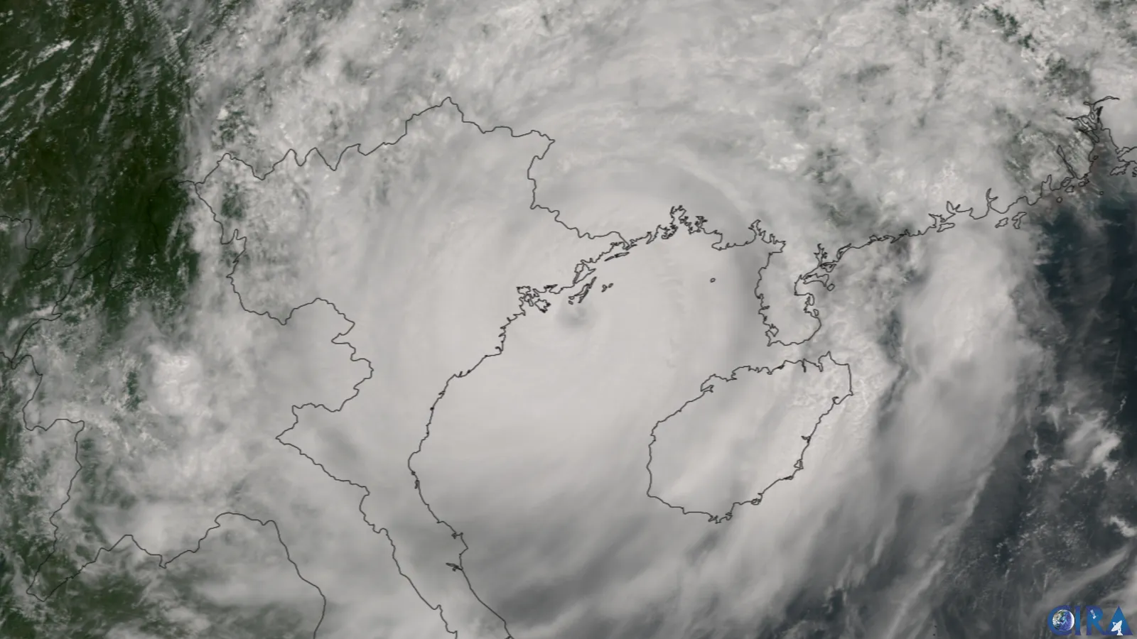
For 2026, a forecaster at the same centre expected tropical depressions and storms to concentrate in October and November in Central Vietnam. The forecaster added that fewer storms does not mean lower risk.
Follow bulletins at nchmf.gov.vn and kttvttb.vn when a storm is forecast. More in Da Nang typhoon season.
Sea conditions and swimming
Lifeguard hours change on 1 October each year, with a switch back on 15 March, according to a Management Board notice posted on 24 March 2023.
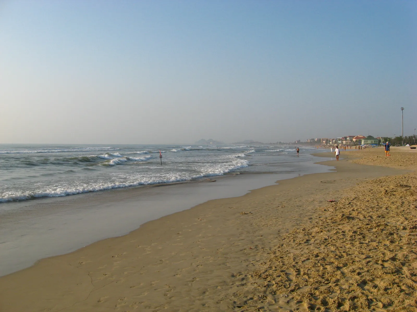
Swim inside the area marked off with safety buoys and yellow-red flags and follow the lifeguards. Do not swim on days of bad weather, rough seas or big waves.
On 6 November 2025, the Management Board halted swimming and water sports from 1:00pm until further notice, for safety as Typhoon No. 13 approached. Full rules are in Da Nang beach swimming safety.
Boats to the Cham Islands
The city tourism portal gives March to August as the ideal time for Cu Lao Cham, when the weather is stable, the sea is calm and the skies are clear.
From September to February the island stays open, but this is the rainy and stormy season. Boats may not operate consistently in rough seas. Details are in Cham Islands from Da Nang.
Air quality by season
The Department of Agriculture and Environment says monitoring shows urban air quality generally at a fairly good level. A May 2025 report adds that it differs between areas and varies with the season. See Da Nang air quality.
Not confirmed: - Dates of this year's Da Nang International Fireworks Festival: check the city tourism page before booking. - Date of the next Lunar New Year: check a calendar before planning travel.
Common questions
Which month has the most rain in Da Nang?
October, with a mean of 628.0 mm, followed by November at 448.2 mm.
Which months are driest?
February, March and April, at 23.6, 25.0 and 35.3 mm of rain.
When is the river flood season?
On rivers from Quang Binh to Ninh Thuan, it runs from 1 September to 15 December.
How many rainy days does Da Nang have in a year?
The station table gives 139.1 rainy days a year.
When is the sea calm for the Cham Islands?
The city tourism portal gives March to August as the ideal time.
Where can I watch live rainfall?
The Da Nang flood map at muangap.danang.gov.vn uses data from 44 rain-gauge stations.
Next in Living in Da Nang
General information checked against the sources listed above, not legal advice for your situation. Rules and office practice change; confirm with the immigration office or a licensed adviser before you act. See how guides are checked.
Spotted an error? Report it.